- Winter Storm Lorraine will hit the Northeast on Monday night and Tuesday.
- Heavy snowfall along with gusty winds will affect the Northeast.
- Snowfall will affect the metropolitan areas of Boston, Hartford, and New York City.
Winter storm Early this week, Lorraine will intensify into a nor’easter, bringing significant snowfall and gusty winds to the East, covering the Boston, Hartford, and New York City metropolitan areas. Given how swiftly the storm is moving east, travel in the area may be impacted throughout the majority of Tuesday.
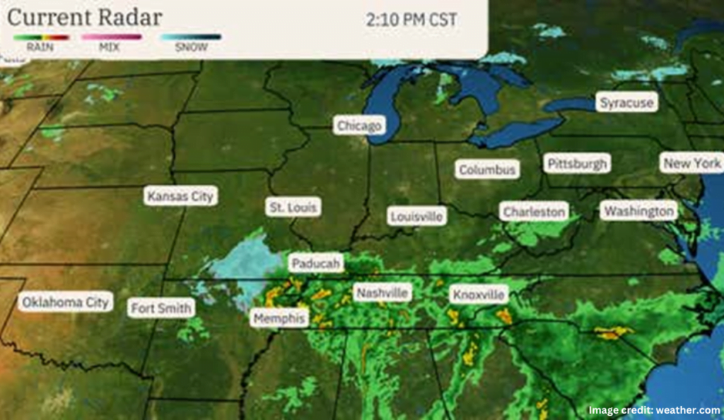
Lorraine’s current location is as follows:
According to the most recent radar, snow is presently falling over several areas of the Ozarks. The South is starting to get rain and thunderstorms.
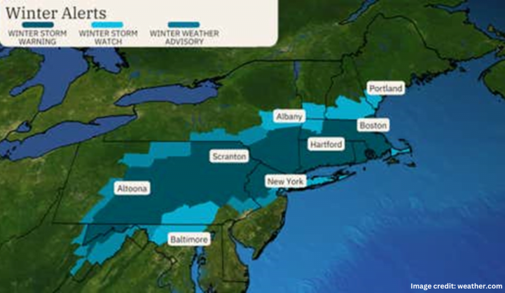
Lorraine’s warnings are issued for the Northeast:
Winter storm warnings have been issued by the National Weather Service for central and northeast Pennsylvania, northern New Jersey, southeast New York, and southern New England.
Depending on where you are in the impacted Northeast regions, expect a perhaps snowy commute on Tuesday morning and/or afternoon. On Tuesday, there may be flight delays at the main hubs in the Northeast, and may disrupt flight operations across many airports in the affected regions like one similar storm recently hit flight operations in 12 states just a month ago.
When a winter storm warning is in force, it is advisable to stay away from the affected areas until the storm passes.
Lorraine’s most recent time and effects are as follows:
Parts of the Appalachians, Ohio Valley, Tennessee Valley, and Ozarks will get precipitation or a combination of rain and snow due to Lorraine through Monday night.
Early Tuesday will bring snow or rain that turns to snow to the Northeast. The snow should impede travel for most of the day throughout the Northeast then taper off from west to east, falling at times at rates of one to three inches per hour. By Tuesday night, most of the snowfall from the storm will have stopped.
In certain places, snowfall may be accompanied by gusts of wind of 30 to 40 mph, which would impair visibility. One cannot completely rule out intermittent power interruptions and some tree damage.
The Tuesday daytime high tide may also cause minor to moderate coastal flooding from southern New England down to the mid-Atlantic coastline. Particularly vulnerable to mild coastal flooding is the Jersey Shore.
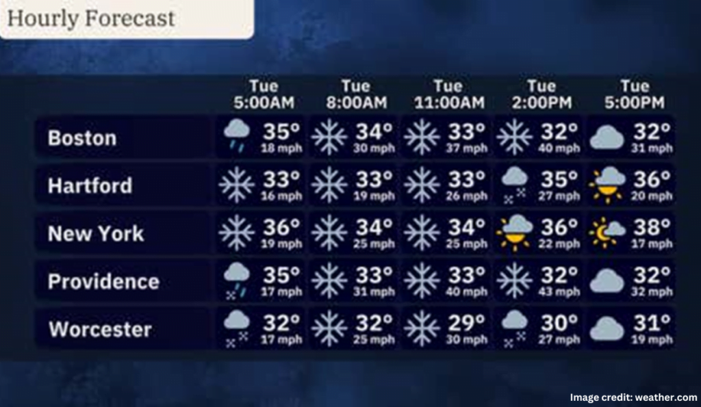
Estimated snowfall amounts are as follows:
Our most recent snowfall prediction for the Northeast is shown on the map below. It is expected that most locations from northeastern Pennsylvania to southeastern New York and southern New England will receive 5 to 12 inches; larger totals may occur locally. The metros in Boston, Hartford, and Providence are included in this.
There could be three to five inches of snow in New York City. Totals here are yet unknown and will be determined by how quickly the rain turns into snow and the storm’s specific route. A faster transition to snow might result in totals above five inches, although a delayed transition could lead to lower totals.
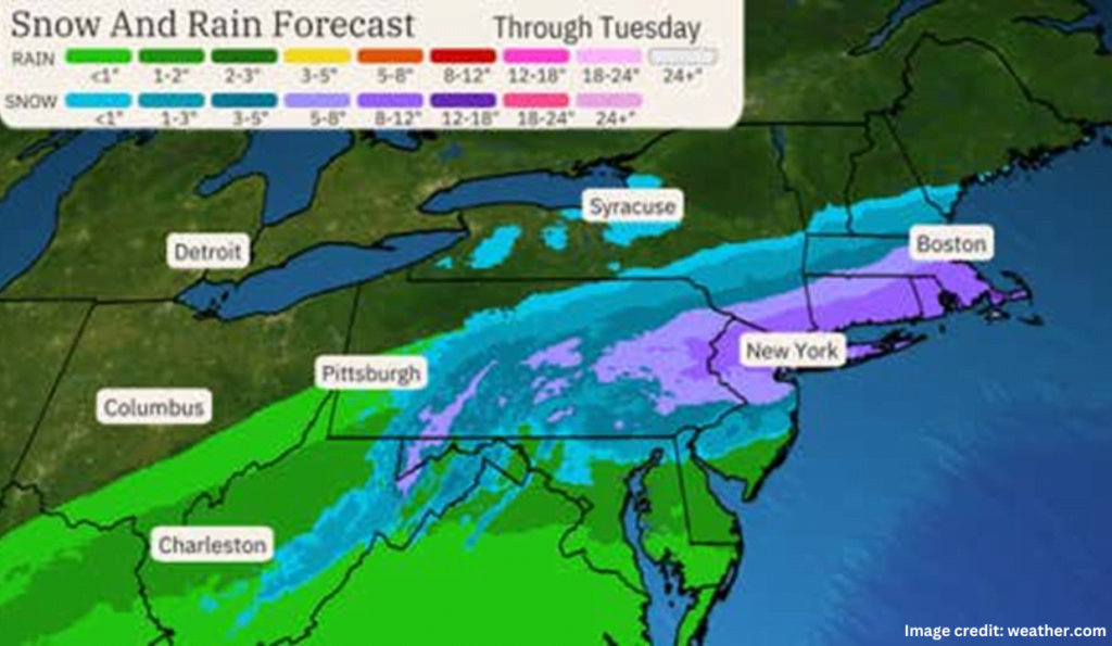
Snow Drought in the Northeast:
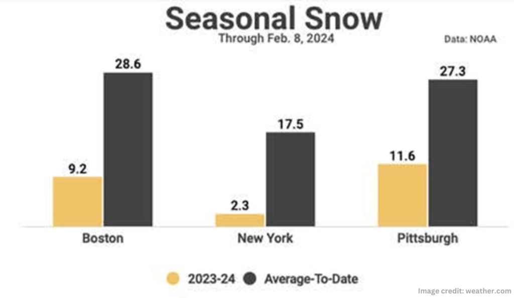
This has been another very mild winter in the Northeast, with little to no snowfall for no less than two weeks now, if not more, since it last snowed.
Through February 8, Boston, New York City, and Pittsburgh all have at least a 15-inch snowfall deficit for the season. With 2.3 inches down, New York is only just ahead of its record-low pace than a year ago, when there were only 0.4 inches.
Usually snowy Syracuse, New York, is the most beautiful. Their season total of 28 inches may seem amazing, but it is 55 inches, or more than 4.5 feet, less than their usual speed. Their season total is the lowest it has been in 91 years.
